Hiking - München / Venedig
From Eng to Wolkenstein
There are several guidebooks available for this renowned hiking trail. If you plan to complete the full route, it typically takes around 30 days. However, we opted to explore a portion of the trail over 12 days.
We traveled from Munich to Lengries by train and then switched to a bus with Eng as our final destination.
Length: 191km, cumulated height: 13.300m
Day Trips
Day 1 - Eng - Karwendelhaus
Length: 16km, cumulated height: 1.200m
On the first day, we experienced some light rain, cold weather, and foggy conditions. As a result, during our first stop at Falkenhütte, we only paused briefly for a drink before continuing to Karwendelhaus.
Karwendelhaus was extremely busy, making it challenging to find a free space for dinner. Despite this, we managed to get a meal and prepared for the next day.

Day 2 - Karwendelhaus - Hallerangerhaus
Length: 15km, cumulated height: 1.450m
The ascent to Bikkarspitze was already a bit challenging due to its steep incline. However, the real surprise came on the descent. I had initially thought the Munich/Venedig trail was suitable for families, but it became clear this is a more demanding hiking route—especially with a fully loaded backpack. The trekking poles proved invaluable during the descent.

Day 3 - Hallerangerhaus - Glugenzer Hütte
Length: 20km, cumulated height: 1.100m
This was a more relaxing day, though rain began to move in, leaving us uncertain about how the next day would unfold. Glugenzer Hütte is charming and simple, with no showers, but it provided a cozy place to stay.
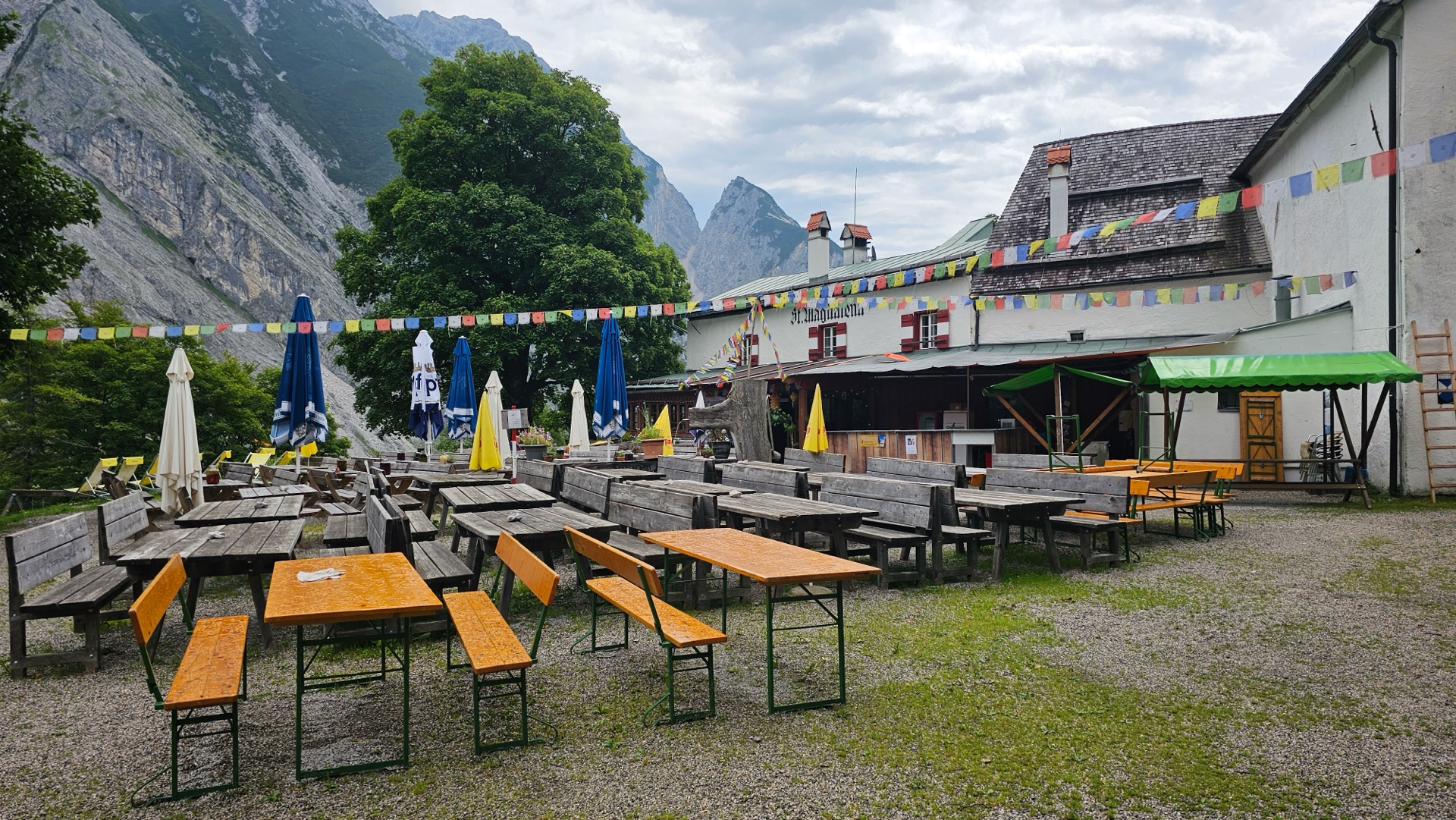
In the photo, you’ll see neither Hallerangerhaus nor Glugenzer Hütte, but rather a Biergarten along the way. It was closed when we stopped by.

Day 4 - Glugenzer Hütte - Lizumer Hütte
Length: 10km, cumulated height: 650m
This day didn’t go as planned. During the evening dinner, we were informed that the normal route to Lizumer Hütte was impassable due to storms and heavy snow, making it too dangerous. There were no viable alternative routes, so nearly everyone opted to take the cable car down, followed by a taxi, and then hiked the remaining section to Lizumer Hütte.

Day 5 - Lizumer Hütte - Tuxer Jochhaus
Length: 16km, cumulated height: 1.200m
The normal trail was not recommended due to lingering snow. However, since our previous day had already become an unplanned detour via taxi, we—and a few others—decided to proceed with the trail to Tuxer Jochhaus. As shown in the photo, the snow made it difficult to locate the trail, and GPS was crucial since trail markers were almost invisible due to the heavy snowfall.
The weather improved throughout the day, though at times the fog was so dense that visibility was limited to just 10 meters ahead.
Upon arriving at Tuxer Jochhaus, the location sounded promising, but the refuge could use some modernization and improvements to both the facilities and the food.

Day 6 - Tuxer Jochhaus - Olperer Hütte
Length: 15km, cumulated height: 900m
The rain had cleared, and we were expecting a beautiful day. Our original plan was to hike to Dominikshütte at Schlegeisspeicher, as Olpererhütte was fully booked. However, upon a second look, we found some available beds at Olpererhütte—known for its famous bridge with Schlegeisspeicher in the background.

Day 7 - Olperer Hütte - Gasthof Stein
Length: 14km, cumulated height: 420m
It was time to cross the border into Italy, and the weather started to warm up. Gasthof Stein is one of the few accommodation options in this area. The room, dinner, and breakfast were all excellent.

Day 8 - Gasthof Stein - Gasthof Brugger / Pfunders
Length: 21km, cumulated height: 1.150m
This was one of the easier days, though some people opt to take the bus to shorten the route.

Day 9 - Pfunders - Kreuzwiesenalm
Length: 27km, cumulated height: 1.400m
A long day, though not overly strenuous. Kreuzwiesenalm is a beautiful spot and quite busy, as it’s accessible by car for hikers who only cover a short section. They produce their own cheese, which we enjoyed extensively during breakfast.

Day 10 - Kreuzwiesenalm - Schlüterhütte
Length: 25km, cumulated height: 1.300m

Day 11 - Schlüterhütte - Puez Hütte
Length: 11km, cumulated height: 780m
Puez Hütte is one of the few locations accessible only by helicopter, resulting in slightly higher prices. The accommodation was fully booked, including even the emergency camp, as some hikers were caught off guard by an approaching storm and needed a place to stay for the night.

Day 12 - Puez Hütte - Wolkenstein
Length: 12km, cumulated height: 400m
On our last day, we left the Munich/Venedig trail at Grödner Joch and hiked down to Wolkenstein. From there, we took a bus back to Munich via train. It was bittersweet to finish, as we had grown accustomed to hiking every day—even in less-than-ideal weather.
